Grand Lake Links, The Free Directory, I Love Grand Lake!!
Message Forum Grand Lake Links Classified Ads & Auctions Grand Lake Fishing Tournaments Grand Lake Area Events Lake Level, Precipitation, Humidity, Wind, Weather Maps, NexRad, Solar Maps, Space Weather and More Grand Lake Photo Wall Grand Lake Member Map Search Tools @ Grand Lake Links Leave Me A VoiceMail Facts about Grand Lake! Grand Lake Links Facebook Page Contact Grand Lake Links Unique Daily Visitors


Show Map Clear Open Information Boxes Click here then Drag the Altimeter Marker to Retrieve Elevation
   Show    Close Altimeter
Clear Map Click here to Change Map Names And Pins
Clear Map Add

Grand Lake Event Map


Grand Lake
Grand Lake O' the Cherokees and the Pensacola Dam provide flood control for the Grand River and produce hydroelectric power for Grand River Dam Authority. Grand Lake is approx. 66 miles long, with some 44,000 surface acres, and about 1,300 miles of shoreline, more than any other lake in the state.

Pensacola Dam is the world's longest multiple arch dam, spanning approximately one mile. The dam towers as much as 150 feet above the riverbed.

Grand Lake O' the Cherokees is one of the most popular tourist attractions in Oklahoma.
Tours of the historic dam are held regularly between Memorial Day and Labor Day. Some of the best rock
crawling in the country for four wheelers is located at the south end of Grand Lake
(directly below the dam) between the towns of Langley and Disney. The area has been
nationally recognized as a destination for 4x4 users.


Grand Lake, Oklahoma's Summer Fun Playground!
The Pensacola Dam

Passing Thoughts

R U Human?


Click    Click Areas    Click Maps

Rating For
vote data
Tell us what you think about
Play These


A Message, 4 All 2 hear
No Typing Required.


I can hear it in your voice

   IE/HTML5    CLR    AutoPlay
Voice Reviews © 2013
Click for Map Statistics
Click our new Like button. :)


Grand Lake Maps
Help Us Help Them Find You

Add your link with a link and other info.
If it is happening at Grand Lake, show us where.


Popup Legend:
The Red Label is the link
 Print Page
Click Here for Directions Get Directions

Map Interface
Copyright© 2009 -
Bill Tucker

My New Grand Lake Maps.
I am trying a few new ideas, you decide.

Altimeter.

Weather Seems to take a long time loading, I may put it back later.

Voice Reviews.
How about saying it in your own words.

Your comments would be appreciated.


Help Us Help Them Find You  

Many of the Google provided locations and details are often wrong.
Use Care not to use their information and make a mistake finding a location or adding a Map Pin.

After 5 years, some of the location data has had some error creep in and some no longer exist.
Please report all incorrect information in the ShoutBox or by Email

This is truly a free service for Grand Lake, and I can use all of the help I can get. Simply by uploading a photo or using your webcam to post your photo of yourself.
Maybe try out the new Voice Reviews.
Press a Star Rating, they are instant ... :)

Thanks!
Bill


Guest Book


Links Exchange :)


Copyright© Grand Lake Links

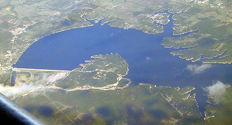
Grand Lake Links
Serving All of Northeastern Oklahoma!!!
Grand Lake O' The Cherokees
Adair, Afton, Bernice, Big Cabin, Bird Island, Blue Bluff Harbor, Bluejacket, Cayuga, Cleora, Copeland,
Dennis, Disney, Dripping Springs, Eucha, Fairland, Grand Lake Towne, Grove, Hickory Grove, Jay, Ketchum, Kansas, Langley,
Monkey Island, Miami, Patricia Island, Pensacola, Pryor, Spavinaw, Strang, TiaJuana, Tiff City, Turkey Ford,
Vinita, Welch, Wyandotte, Zena.